
Last spots published by the community
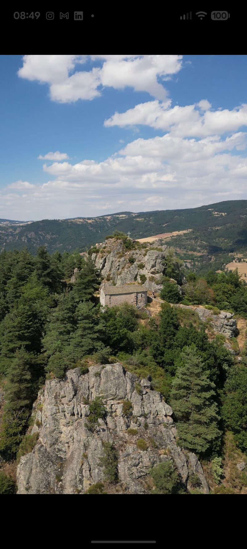
Chapelle Saint-Etienne de Douchanez
Petite chapelle au pied d'un chaos granitique, dominant la vallée d...
yesterday
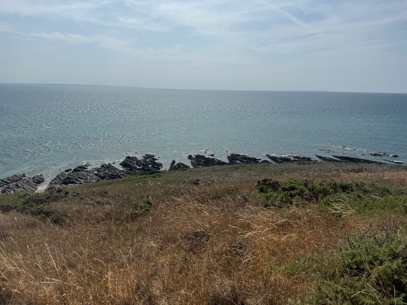
Le rozel
De belles roches en pointe du rozel et des spots sympas pour le déc...
yesterday
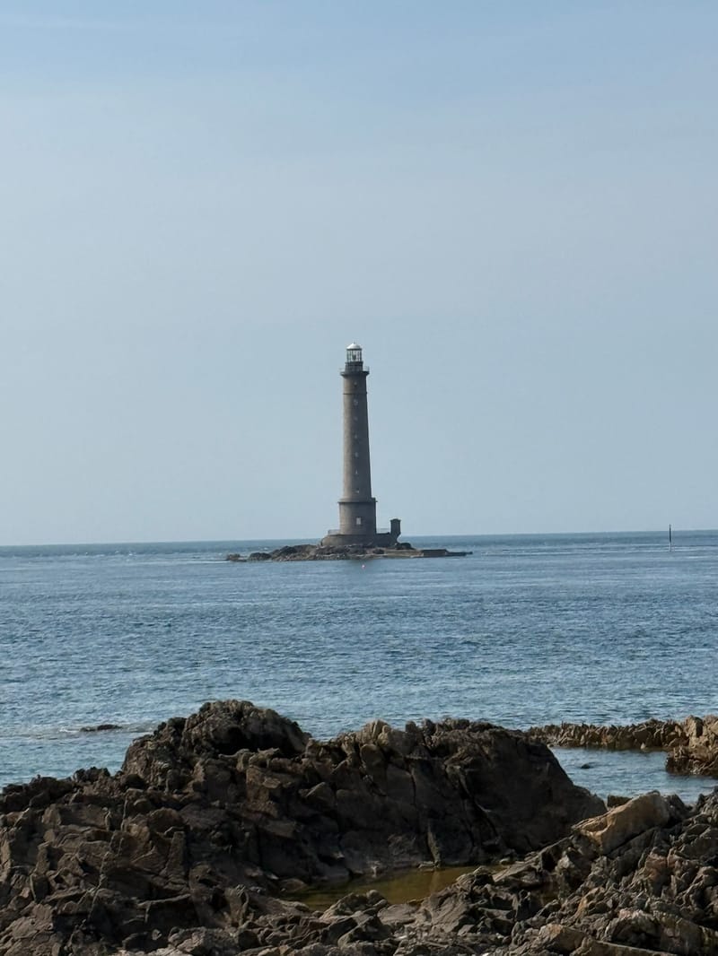
Phare de goury
Attention au période de reproduction de certains oiseaux l’accès es...
2 days ago
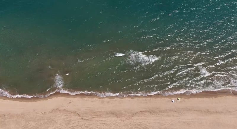
Mer St pierre la mer
Tout le coin autour est libre d’accès et super sympa.
2 days ago
Trusted by drone pilots worldwide
Active Users this week
Drone Spots
App Store Rating
What pilots say about us
DroneSpot helped me find amazing locations I never would have discovered on my own. The weather forecasts have saved me numerous wasted trips!
Michael Johnson
Drone Pilot since 2019
The community features are fantastic! I've connected with other local drone enthusiasts and we now fly together regularly. Highly recommended!
Sarah Lee
FPV Enthusiast
As a professional drone photographer, I rely on DroneSpot to plan my shoots. The detailed information about each location has been invaluable.
Thomas Peters
Aerial Photographer
Download our mobile app for the best experience


Find your next drone spot !
Find a drone spot near you
DroneSpot is the community-driven map of drone spots across France and Europe. Whether you fly a recreational drone or an FPV rig, find a suitable flying spot in seconds: open fields, beaches, mountains or approved scenic viewpoints. Every drone spot is shared and verified by the community, with photos, access details and flying conditions.
Before you take off, check drone flight zones, restrictions and no-fly areas right on the map, along with real-time weather (wind, visibility, precipitation). DroneSpot brings together more than 15,000 drone spots and up-to-date regulations so you always know where you can legally fly your drone.
Frequently Asked Questions
Everything you need to know about DroneSpot. Can't find the answer you're looking for? Contact our support team.
Yes, DroneSpot is completely free to use! You can access all basic features including:
- Mapping and exploring drone spots
- Community features and interaction
- Basic weather information
We also offer premium features for extended weather forecasting and additional tools for a small subscription fee.
To add a new spot, follow these simple steps:
- Log in to your DroneSpot account
- Navigate to the map view
- Click on the "Create a Spot" button
- Fill in details about the location, add photos, and select relevant categories
- Submit your spot for review
After submission, your spot will be reviewed by our team and added to the map within 24-48 hours.
Each spot includes detailed information to help you plan your flight:
Premium users get additional features like extended weather forecasts and downloadable flight logs.
Before every take-off, check the drone flight-zone map at the exact spot where you plan to fly. In France, several things determine whether a zone is allowed:
- No-fly areas and restrictions (CTR, P, R and D zones around airports and sensitive sites)
- The maximum allowed flight altitude, often lowered near aerodromes
- The authorizations required depending on the flight category and drone regulations
On Drone Spot, open the map and zoom in on your location: flight zones, restrictions and authorizations are shown directly, based on the same official data as Géoportail but verified and enriched, with real-time weather.
💡 Astuce : Always check the map on the day of your flight: some temporary restrictions (NOTAMs, events) can change at any time.
Drone Spot is not meant to replace DJI Fly, which is DJI's official app for piloting and configuring your drone. However, Drone Spot is an app to consult the Géoportail map with additional features!
Drone Spot vs Géoportail:
- Same flight zone source
- Precise weather data integrated into each spot (wind, humidity, satellites...)
- Access to more than 1,500 spots referenced by the community
- Ability to easily filter, save and explore the best locations
DJI Fly = for piloting your drone
Drone Spot = for safely planning your flight and finding the best spots