1. Home
  2. Allemagne
  3. Rhénanie-du-Nord-Westphalie
  4. Königswinter
Königswinter

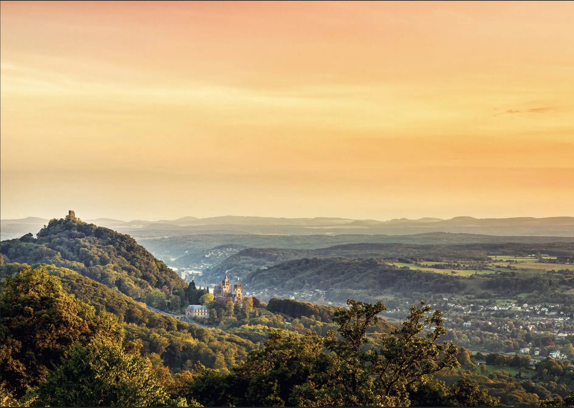
Drachenfels

Coordenadas50.66737, 7.20684
Publicado porVisiteur web
01 may 2019 · 00:00
Puntuación de la comunidad
0

Inicia sesión para votar

Meteorología aeronáutica· 04
Comentarios· 05

Aún no hay comentarios. ¡Sé el primero!

Inicia sesión para comentar

Lugares cercanos· 06
  • Ahrweiler - Rheinland-PfalzRemagen8,4 km
  • Mülheim - KölnCologne35,2 km
  • Mayen-Koblenz - Rheinland-PfalzSankt Sebastian37,9 km
  • Forteresse d'EhrenbreitsteinCoblence44,3 km
  • Oberbergischer Kreis - KölnGummersbach47,3 km
  • Oberbergischer Kreis - KölnBergneustadt49,7 km
  • Gummersbach - Oberbergischer KreisGummersbach51,4 km
  • Campingplatz PommernPommern55,6 km
Viento en directo· 07
Windy
Drachenfels
Briefing del piloto
Dificultad
1/3
Principiante
Accesibilidad
2/3
Mediamente accesible
Descripción

One of the many mountains in the Siebengebirge is this one called ''Petersberg'', which is near the Rhine and offers a great view over Bonn and ''Drachenfels''. There is free parking at the top of Petersberg, but sometimes you have to pay a small fee if you want to get up there by car. Photo by Manuel Becker www.manuelbecker.net
Restricciones aquí· 03

No hay restricciones conocidas en este punto.

Compruebe siempre antes de volar — la cobertura depende de los datos publicados por su país.

jue, 12 nov
22:10
Condiciones
Amanecer
Atardecer
Precipitaciones
Temperatura
Índice KP
Cobertura nubosa
Viento
Rachas
Visibilidad
Humedad
Satélites
DroneSpot Pro

Planifica con anticipación y encuentra tus ventanas de vuelo con acceso a pronósticos detallados de 10 días que muestran condiciones, satélites, viento, índice kp y más.