1. Home
  2. Israël
  3. district centre
  4. Netanya
Netanya

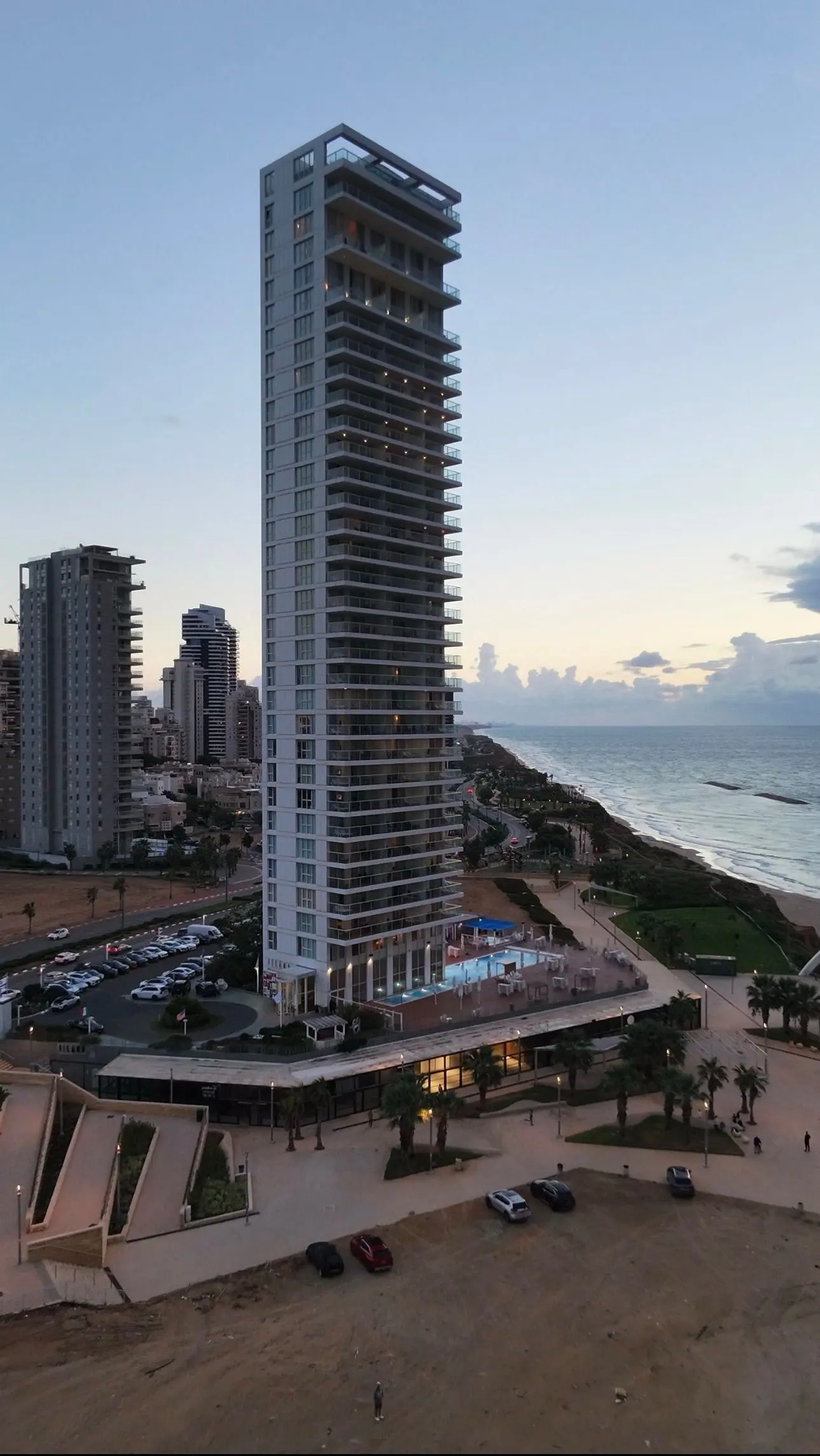
Island Tower, Netanya | Sunset Drone Flyaway in 4K

Coordenadas32.31157, 34.84525
Publicado poradam_wisher
07 nov 2026 · 05:20
Pontuação da comunidade
-1

Inicie sessão para votar

Categorias
🏭 Bando➰ Freestyle📡 Long range🏁 Racing
Meteorologia aeronáutica· 04
Comentários· 05

Ainda não há comentários. Seja o primeiro!

Inicie sessão para comentar

Locais próximos· 06
  • Poleg Beach, Netanya, IsraelNetanya3,3 km
  • Center District - Israel15,1 km
  • Stormy Waves in Old Tel Aviv Port, IsraelTel Aviv25 km
  • South District - Israel64 km
  • North District - Israel75,6 km
  • Spot de la merNahariah80,8 km
Vento ao vivo· 07
Windy
Island Tower, Netanya | Sunset Drone Flyaway in 4K
Briefing do piloto
Dificuldade
2/3
Média
Acessibilidade
2/3
Mediamente acessível
Descrição

A beautiful cinematic aerial view of Island Tower on the Mediterranean coastline of Netanya, Israel. Captured with a DJI Neo 2 during the blue hour, just after sunset, this shot begins near the impressive beachfront skyscraper before the drone slowly flies backward, revealing the surrounding city, coastal cliffs, and the endless Mediterranean Sea. The smooth backward movement creates a dramatic sense of depth, while the soft evening sky, illuminated balconies, and gentle reflections on the water bring a peaceful atmosphere to the scene. The combination of modern architecture, dramatic coastal scenery, and the Mediterranean horizon makes this an excellent location for cinematic drone photography. Location: Island Tower, Netanya, Israel Drone: DJI Neo 2 Resolution: 4K Flight movement: Slow backward flyaway Lighting: Sunset / Blue Hour #DJINeo2 #Netanya #IslandTower #Israel #DroneVideo #4K #DronePhotography #MediterraneanSea #CinematicDrone #AerialPhotography
Restrições aqui· 03

Sem restrições conhecidas neste ponto.

Verifique sempre antes de voar — a cobertura depende dos dados publicados pelo seu país.

 
--:--
Condições
Nascer do sol
Pôr do sol
Precipitação
Temperatura
Índice KP
Cobertura de nuvens
Vento
Rajadas de vento
Visibilidade
Umidade
Satélites
Drone Spot Pro

Planeje com antecedência e encontre suas janelas de voo com acesso a previsões detalhadas de 10 dias mostrando condições, satélites, vento, índice kp e muito mais.