1. Home
  2. France
  3. Occitanie
  4. Ariège
  5. Fornex
Fornex

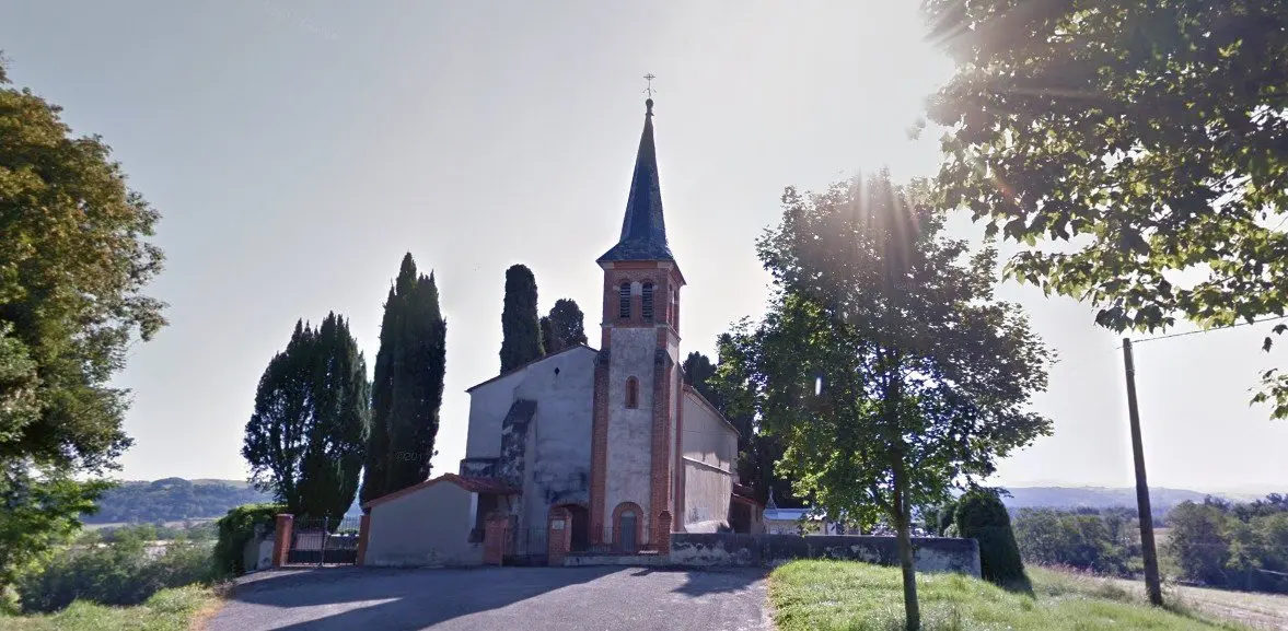
L'église de Fornex

Coordinates43.16976, 1.25087
Published byleo_nidas
08 Mar 2018 · 12:00 AM
Community score
0

Log in to vote

Categories
➰ Freestyle📡 Long range🌳 Arbres
Aviation weather· 04
Comments· 05

No comments yet. Be the first!

Log in to comment

Nearby spots· 06
  • La Garonne MauzacMauzac22.7 km
  • La Garonne MauzacMauzac22.8 km
  • Chapelle Saint AmansMuret26.5 km
  • Chapelle Saint AmansMuret26.5 km
  • champsLagardelle-sur-Lèze28.6 km
  • lagardelle sur lezeLagardelle-sur-Lèze28.7 km
  • Chateau de MontespanMontespan33.7 km
  • Canal du midiAyguesvives41.9 km
Live wind· 07
Windy
L'église de Fornex
Pilot briefing
Difficulty
3/3
Hard Level
Accessibility
2/3
Moderately accessible
Description

Un lieu magnifique quand il y a du soleil , ses alentours , champs en contre-bas aussi sont plutôt jolis quand ils ne sont pas labourés car cela ajoute de la couleur . Personnellement , j'ai pus voler au dessus de la Bastide de Besplas sans problème , autorisation du maire qui était émerveillée par cette technologie (lol) .
Can I fly here?· 03

Flight allowed

No regulated zone at this spot. Fly up to 120 m, in daylight, with your drone in sight, away from people.

Max height : 120 m

A local order (prefecture, town hall) may also restrict flying. Stay alert on site.

Computed on November 16 at 01:32 PM

See on the map
Mon, Nov 16
12:32 PM
Conditions
Sunrise
Sunset
Precipitations
Temperature
KP index
Cloud cover
Wind speed
Wind gust
Visibility
Humidity
Satellites
DroneSpot Pro

Plan your flights in advance and find your windows with access to detailed 10-day forecasts showing conditions, satellites, wind, kp index, and more.