1. Home
  2. France
  3. Hauts-de-France
  4. Nord
  5. Hallennes-lez-Haubourdin
Hallennes-lez-Haubourdin

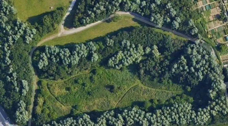
Clairière entourée d'arbres

Coordinates50.60899, 2.95685
Published bygul87
06 Jun 2020 · 03:22 PM
Community score
0

Log in to vote

Aviation weather· 04
Comments· 05

No comments yet. Be the first!

Log in to comment

Nearby spots· 06
  • Château de PremesquesPrémesques5.1 km
  • Parc des aubépinesFaches-Thumesnil7.6 km
  • Etangs du Pont BallotHouplines9.2 km
  • Etang de FrelingheimFrelinghien10.7 km
  • Hippodrome de MarcqMarcq-en-Barœul11.6 km
  • Stade de SaloméSalomé11.6 km
  • Chateau d'eauNieppe12.5 km
  • Parc de nature et loisirs Marcel cabidduWingles13.4 km
Live wind· 07
Windy
Clairière entourée d'arbres
Pilot briefing
Difficulty
2/3
Medium
Accessibility
2/3
Moderately accessible
Description

Attention en bordure de NFZ. Altitude max 50m. 2 clairières entourées d'arbres, d'une petite surface, accessibles à pieds ou vélos uniquement. Pas trop exposées au vent en dessous des arbres. Parking stade de foot à proximité. Promeneurs occasionnels. Vue sur Hallennes les Haubourdin et alentours.
Can I fly here?· 03

Prohibited in public spaces

You are in a built-up area. Leisure flights are prohibited in public spaces here.

Max height : —

  • Built-up areaProhibited

    Leisure flights are prohibited in public spaces.

  • [LF][CTR LILLE]Conditional

    The zone starts 50 m above the ground: stay below it.

A local order (prefecture, town hall) may also restrict flying. Stay alert on site.

Computed on November 19 at 09:16 PM

See on the map
 
--:--
Conditions
Sunrise
Sunset
Precipitations
Temperature
KP index
Cloud cover
Wind speed
Wind gust
Visibility
Humidity
Satellites
Drone Spot Pro

Plan your flights in advance and find your windows with access to detailed 10-day forecasts showing conditions, satellites, wind, kp index, and more.