1. Home
  2. France
  3. Occitanie
  4. Tarn-et-Garonne
  5. Montech
Montech

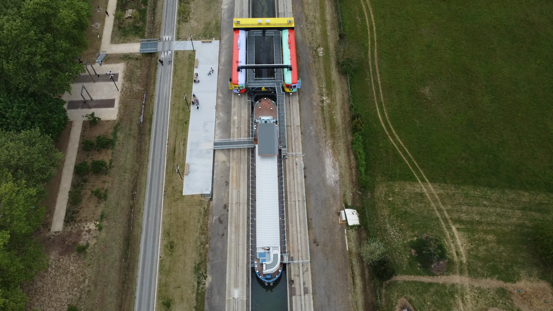
Pente d'eau de MONTECH

Coordinates43.97300, 1.22412
Published byVisiteur web
04 Jul 2021 · 12:48 PM
Community score
0

Log in to vote

Aviation weather· 04
Comments· 05

No comments yet. Be the first!

Log in to comment

Nearby spots· 06
  • lac de grisollesPompignan19.8 km
  • Forêt de BouconneDaux34.2 km
  • St Loup-CammasSaint-Loup-Cammas36.1 km
  • base de loisirs des Quinze SolsBeauzelle36.7 km
  • Moulin de NaudinBeauzelle36.8 km
  • Quinze Sols BeauzelleBeauzelle36.9 km
  • Lac de la BordettePibrac37 km
  • Stade de la croix DanielTournon-d'Agenais51.2 km
Live wind· 07
Windy
Pente d'eau de MONTECH
Pilot briefing
Difficulty
2/3
Medium
Accessibility
2/3
Moderately accessible
Description

Sur le canal latéral à la Garonne, La pente d'eau, une machine fraichement rénové, permettait au bateau de contourner 5 écluses. Avec un parking a 1km au niveau de l'ancienne usine aujourd'hui office du tourisme, ou en basse saison, parking sur site. Attention au fils électriques qui dont malheureusement présents sur le site. Hauteur de vol 50 m Présence d'habitation a proximité.
Can I fly here?· 03

Conditional: aerodrome agreement

Near an aerodrome, flying above the height shown requires the agreement of its operator or of air traffic control.

Max height : 48 m

  • Near an aerodromeConditional

    Above 48 m, the flight requires the agreement of the aerodrome operator or of air traffic control.

A local order (prefecture, town hall) may also restrict flying. Stay alert on site.

Computed on November 16 at 01:32 PM

See on the map
Mon, Nov 16
12:32 PM
Conditions
Sunrise
Sunset
Precipitations
Temperature
KP index
Cloud cover
Wind speed
Wind gust
Visibility
Humidity
Satellites
DroneSpot Pro

Plan your flights in advance and find your windows with access to detailed 10-day forecasts showing conditions, satellites, wind, kp index, and more.