1. Home
  2. France
  3. Bourgogne-Franche-Comté
  4. Vendenesse-lès-Charolles
Vendenesse-lès-Charolles

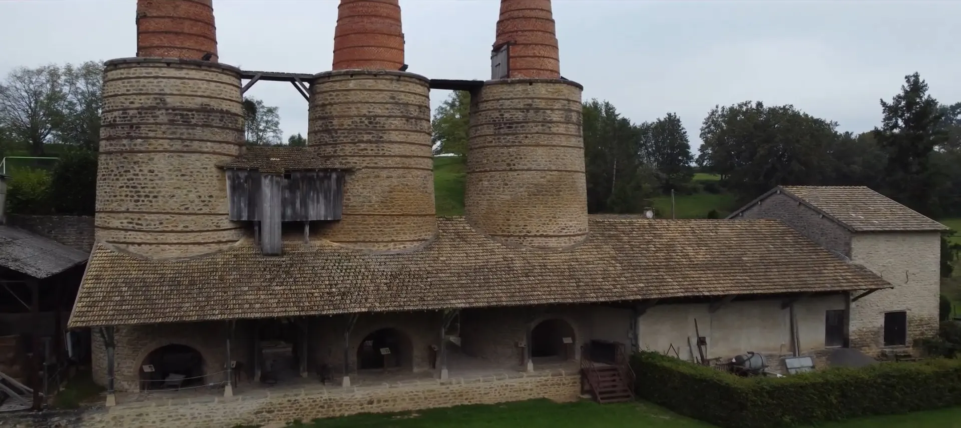
Les fours à chaux

Coordinates46.43230, 4.31382
Published byVisiteur web
14 Oct 2021 · 10:20 PM
Community score
0

Log in to vote

Aviation weather· 04
Flight footage· 05
Comments· 06

No comments yet. Be the first!

Log in to comment

Nearby spots· 07
  • Mémorial de la résistance de BeauberyBeaubery7.5 km
  • Butte de Suin 593, son incroyable panorama a 360º et sa viergeSuin12.2 km
  • SuinSuin12.4 km
  • Mont Saint-CyrMontmelard14.7 km
  • Lac de Saint-PointSaint-Point25.3 km
  • Mont saint-VincentMont-Saint-Vincent25.3 km
  • Parc Maugrand et sa pyramide ( Montceau les mines)Montceau-les-Mines28 km
  • Viaduc du Châtelard (Monsols) et cascade du SautDeux-Grosnes28 km
Live wind· 08
Windy
Les fours à chaux
Pilot briefing
Difficulty
1/3
Beginner
Accessibility
2/3
Moderately accessible
Description

Les fours à chaux de vendenesse les charolles, classés au patrimoine historique industriel
Restrictions here· 03

No known restrictions at this point.

Always cross-check before flying — coverage depends on your country's published data.

Tue, Nov 10
7:54 AM
Conditions
Sunrise
Sunset
Precipitations
Temperature
KP index
Cloud cover
Wind speed
Wind gust
Visibility
Humidity
Satellites
DroneSpot Pro

Plan your flights in advance and find your windows with access to detailed 10-day forecasts showing conditions, satellites, wind, kp index, and more.