1. Home
  2. France
  3. Auvergne-Rhône-Alpes
  4. Les Allues
Les Allues

Montagne

Coordinates45.33801, 6.57254
Published bytintingss
08 Feb 2022 · 05:03 PM
Community score
0

Log in to vote

Aviation weather· 04
Comments· 05

No comments yet. Be the first!

Log in to comment

Nearby spots· 06
  • Roc de TougneLes Allues2 km
  • Le plan de l'eau des BruyèresLes Belleville3.9 km
  • Vacance d'été a LongchampSaint François Longchamp18.6 km
  • Les 3 croix, Col du Télégraphe SavoieValloire19.2 km
  • La plagneLa Plagne Tarentaise20.7 km
  • Refuge du Lac de La Grande LechereSaint François Longchamp21.8 km
  • Belle PlagneLa Plagne Tarentaise22.9 km
  • Notre dame des VernettesPeisey-Nancroix27.9 km
Live wind· 07
Windy
Montagne
Pilot briefing
Difficulty
2/3
Medium
Accessibility
2/3
Moderately accessible
Description

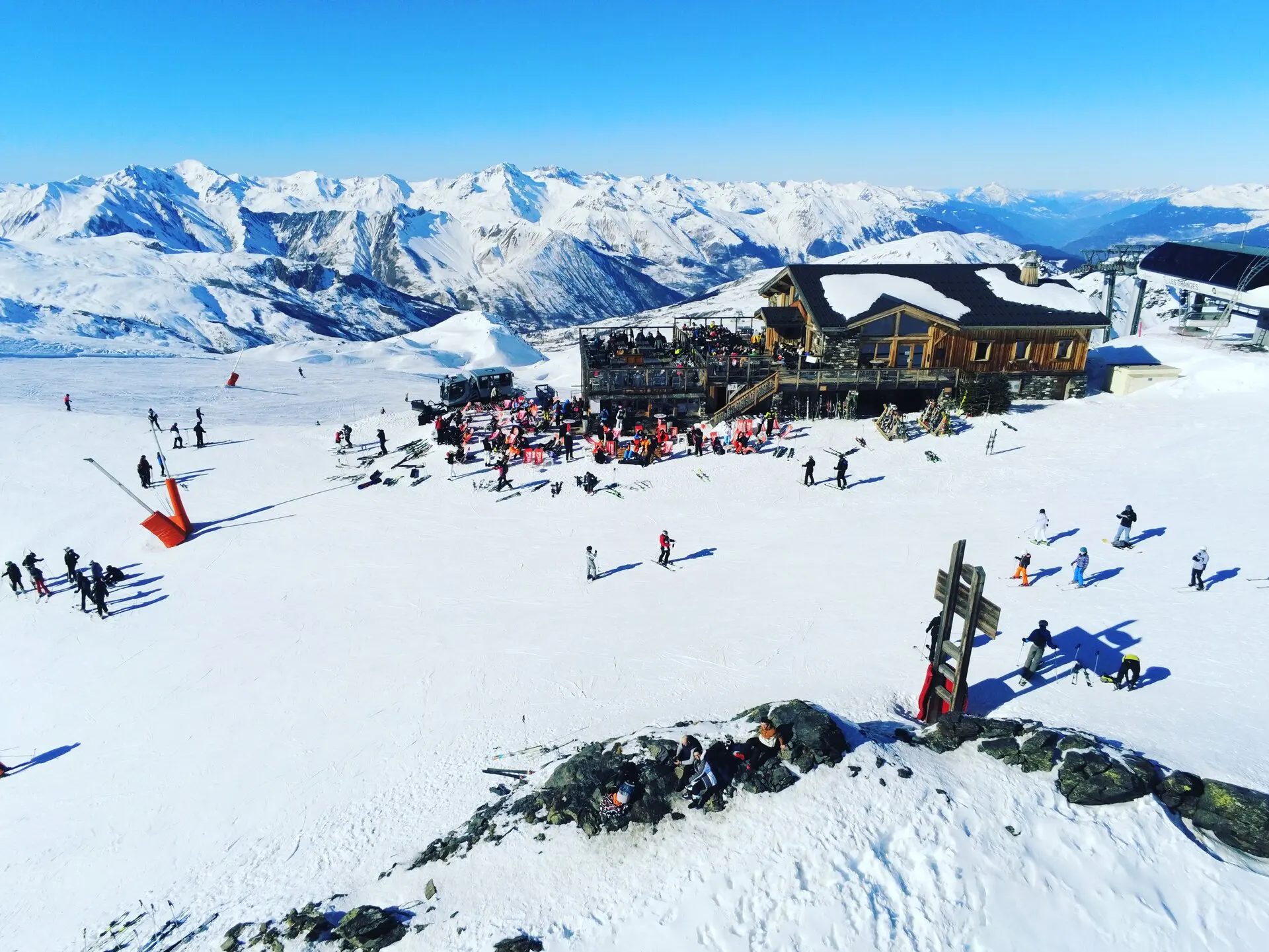
En haut du mont à 2700 m d’altitude
Restrictions here· 03
5 active rules
  • [LF][PRN 365] PLAN DE TUEDAAerodrome / other · No-fly
  • OBActive now
  • OBActive now
  • OBActive now
  • OBActive now
Tue, Nov 10
6:19 AM
Conditions
Sunrise
Sunset
Precipitations
Temperature
KP index
Cloud cover
Wind speed
Wind gust
Visibility
Humidity
Satellites
DroneSpot Pro

Plan your flights in advance and find your windows with access to detailed 10-day forecasts showing conditions, satellites, wind, kp index, and more.