1. Home
  2. France
  3. Nouvelle-Aquitaine
  4. Gironde
  5. Lège-Cap-Ferret
Lège-Cap-Ferret

SUR LE BASSIN D'ARCACHON, VUE DU CIEL DE LA CONCHE

Coordinates44.63469, -1.24508
Published byVisiteur web
01 Jun 2022 · 05:30 PM
Community score
0

Log in to vote

Aviation weather· 04
Flight footage· 05
Comments· 06

No comments yet. Be the first!

Log in to comment

Nearby spots· 07
  • Plage du mimbeau, Cap-ferretLège-Cap-Ferret1.2 km
  • La jetée du moulonArcachon3.3 km
  • Jetée le moulonArcachon3.3 km
  • Arcachon, plageArcachon6.8 km
  • drone airportLa Teste-de-Buch9 km
  • Ares bassin d arcachon Arès16 km
  • Plage de LantonLanton17.3 km
  • Marcheprime - GirondeMarcheprime32.2 km
Live wind· 08
Windy
SUR LE BASSIN D'ARCACHON, VUE DU CIEL DE LA CONCHE
Pilot briefing
Difficulty
1/3
Beginner
Accessibility
1/3
Easy to access
Description

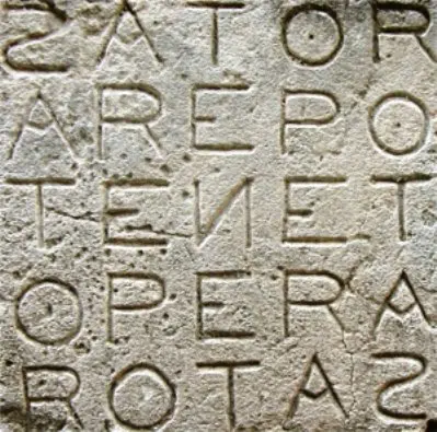
Spot accessible par la route (stationnement gratuit pour le moment ;-) ) et à pieds avec des chaussures pour éviter de marcher sur des coquilles d’huitres des parcs à huitres… On remarquera la possibilité de faire des ROTAtions (ROTAS ;-)) Dune du Pila, les 44 ha, Hortense, le Phare … Pour éviter les dégradations irréversibles , merci de laisser le lieux en l'Etat : ''très net '' ;-) Pour éviter les problèmes, faire la check list et prévoir de partir en composante vent de face pour revenir en composante vent de dos … La détection automatique d’obstacles n’est pas indispensable car il n’y a pas d’arbres et les bateaux sont au mouillage. A titre indicatif, les petits dériveurs solitaires Optimist dominent avec des Hauteur de mât inférieurs à 3m (2,26 m).
Can I fly here?· 03

Conditional: aerodrome agreement

Near an aerodrome, flying above the height shown requires the agreement of its operator or of air traffic control.

Max height : 71 m

  • Near an aerodromeConditional

    Above 71 m, the flight requires the agreement of the aerodrome operator or of air traffic control.

A local order (prefecture, town hall) may also restrict flying. Stay alert on site.

Computed on November 16 at 01:39 PM

See on the map
Mon, Nov 16
12:39 PM
Conditions
Sunrise
Sunset
Precipitations
Temperature
KP index
Cloud cover
Wind speed
Wind gust
Visibility
Humidity
Satellites
DroneSpot Pro

Plan your flights in advance and find your windows with access to detailed 10-day forecasts showing conditions, satellites, wind, kp index, and more.