1. Home
  2. France
  3. Bourgogne-Franche-Comté
  4. Côte-d'Or
  5. Velars-sur-Ouche
Velars-sur-Ouche

Notre Dame D'étang

Coordinates47.30453, 4.90072
Published bymanudrone
04 Nov 2018 · 12:00 AM
Community score
0

Log in to vote

Aviation weather· 04
Comments· 05

No comments yet. Be the first!

Log in to comment

Nearby spots· 06
  • Velars sur Ouche - Notre Dame d'EtangVelars-sur-Ouche< 1 km
  • Plombières lès Dijon - Porte du DiableDaix7.6 km
  • Lac Kir de Dijon depuis le belvédère de Talant (21)Talant8.3 km
  • Grosbois/Bourgogne (Côte d’Or)Grosbois-en-Montagne22.3 km
  • Grosbois/Bourgogne (Côte d’Or)Grosbois-en-Montagne22.3 km
  • Grosbois/Bourgogne (Côte d’Or)Grosbois-en-Montagne22.3 km
  • Magnifique église dans la campagneDiénay27.4 km
  • Mont saint SiméonSaulx-le-Duc27.4 km
Live wind· 07
Windy
Notre Dame D'étang
Pilot briefing
Difficulty
1/3
Beginner
Accessibility
2/3
Moderately accessible
Description

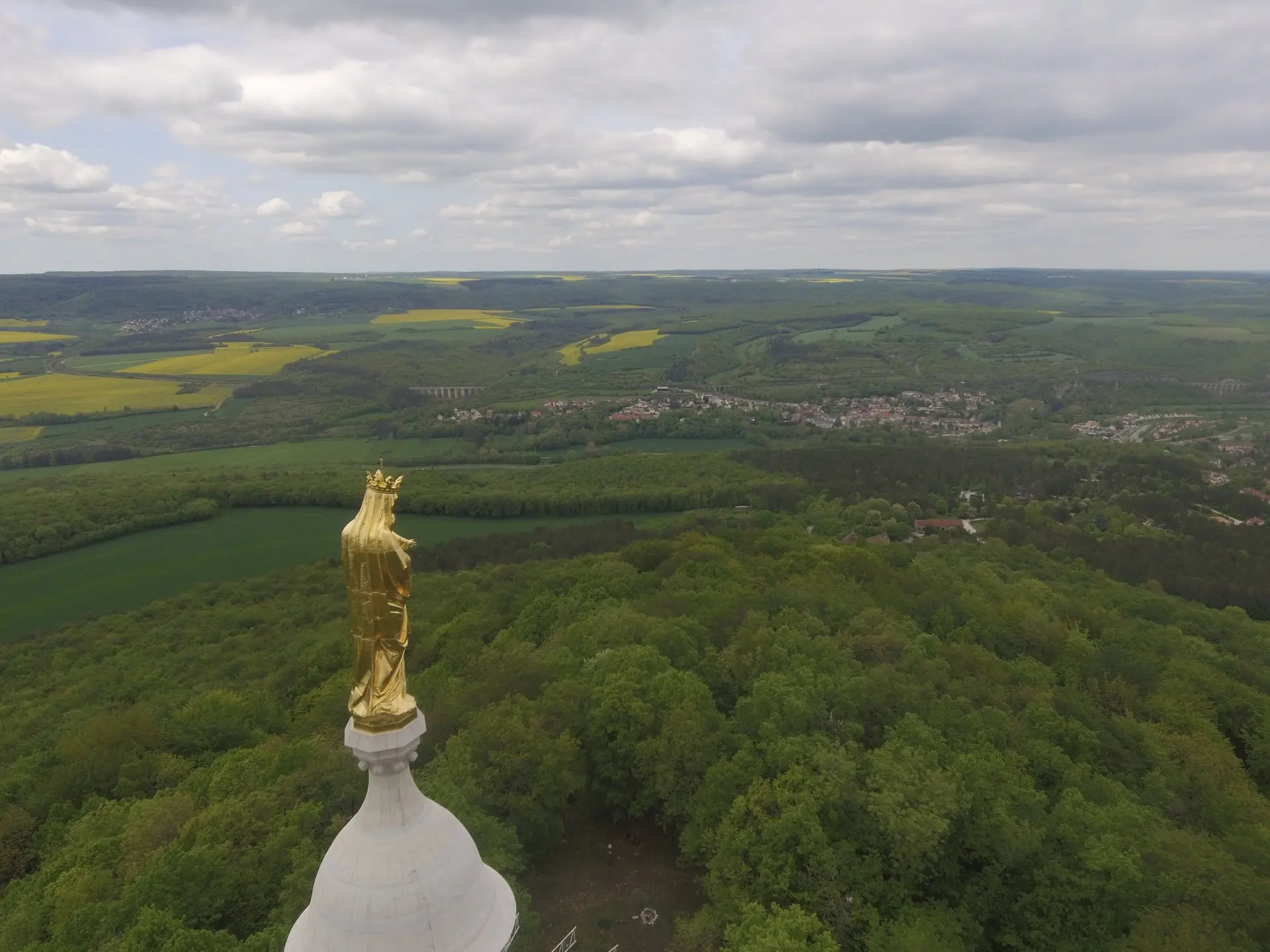
Notre Dame d'étang est une petite chapelle surmontée d'une belle statue de la Vierge Marie. Elle est située au sommet d'une petite colline qu'il faudra gravir à pieds. La montée n'est pas très longue depuis le parking le plus proche mais il y a tout de même un petit dénivelé. La vue offerte grâce au drone vous récompensera de ''l'ascension''. Attention cependant à la piste d'envol de parapentes à quelques dizaines de mètres et donc surtout au potentiels parapentistes. Il y a aussi de grands arbres auxquels il faut faire attention mais qui ne présentent aucuns dangers directs.
Can I fly here?· 03

Flight allowed

No regulated zone at this spot. Fly up to 120 m, in daylight, with your drone in sight, away from people.

Max height : 120 m

  • NOTAM W2493/26No known restriction

    NOTAM in force at this spot. Read it before flying.

  • Arrière côte de Dijon et de BeauneNo known restriction

    Protected area with no known overflight ban. Respect wildlife and plants.

A local order (prefecture, town hall) may also restrict flying. Stay alert on site.

Computed on November 16 at 03:01 PM

See on the map
Mon, Nov 16
2:01 PM
Conditions
Sunrise
Sunset
Precipitations
Temperature
KP index
Cloud cover
Wind speed
Wind gust
Visibility
Humidity
Satellites
DroneSpot Pro

Plan your flights in advance and find your windows with access to detailed 10-day forecasts showing conditions, satellites, wind, kp index, and more.