1. Home
  2. France
  3. Pays de la Loire
  4. Nantes
Nantes

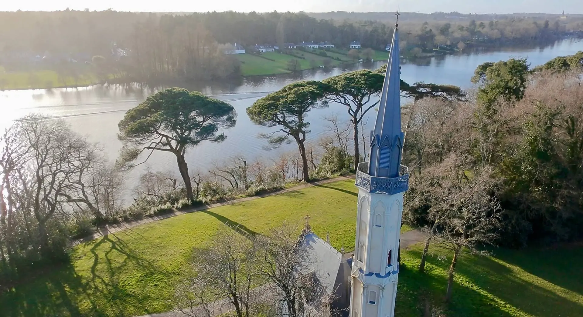
Chapelle de la Chantrerie

Coordinates47.28555, -1.52504
Published bypadipo
23 Feb 2025 · 12:10 PM
Community score
0

Log in to vote

Categories
🌊 Plan d'eau🌳 Arbres
Aviation weather· 04
Flight footage· 05
Comments· 06

No comments yet. Be the first!

Log in to comment

Nearby spots· 07
  • Parc RoseraieNantes1.8 km
  • Bord de l’erdreNantes2.7 km
  • Horticulture abandonnéOrvault5.9 km
  • Île chesnetSaint-Julien-de-Concelles7.4 km
  • Château de la tour en FPVOrvault7.6 km
  • Le bout des PontsSaint-Julien-de-Concelles7.9 km
  • Parc salle Paul bouinBasse-Goulaine8.6 km
  • Vieux moulinDivatte-sur-Loire11 km
Live wind· 08
Windy
Chapelle de la Chantrerie
Pilot briefing
Difficulty
2/3
Medium
Accessibility
2/3
Moderately accessible
Description

Grand parc en périphérie de Nantes, sur les rives de l’Erdre.
Can I fly here?· 03

To confirm: source out of date

A source used for this point is out of date. Check the official information before flying.

Max height : 120 m

  • Source out of dateTo be confirmed

    The “Protected areas (INPN)” data is out of date for this point: check the official information before flying.

  • Noctule commune à Nantes, à Rezé et à VertouTo be confirmed

    An overflight rule may apply in this protected area.

A local order (prefecture, town hall) may also restrict flying. Stay alert on site.

Computed on November 13 at 01:11 PM

See on the map
Fri, Nov 13
12:11 PM
Conditions
Sunrise
Sunset
Precipitations
Temperature
KP index
Cloud cover
Wind speed
Wind gust
Visibility
Humidity
Satellites
DroneSpot Pro

Plan your flights in advance and find your windows with access to detailed 10-day forecasts showing conditions, satellites, wind, kp index, and more.