1. Home
  2. France
  3. Provence-Alpes-Côte d'Azur
  4. Alpes-de-Haute-Provence
  5. Montagnac-Montpezat
Montagnac-Montpezat

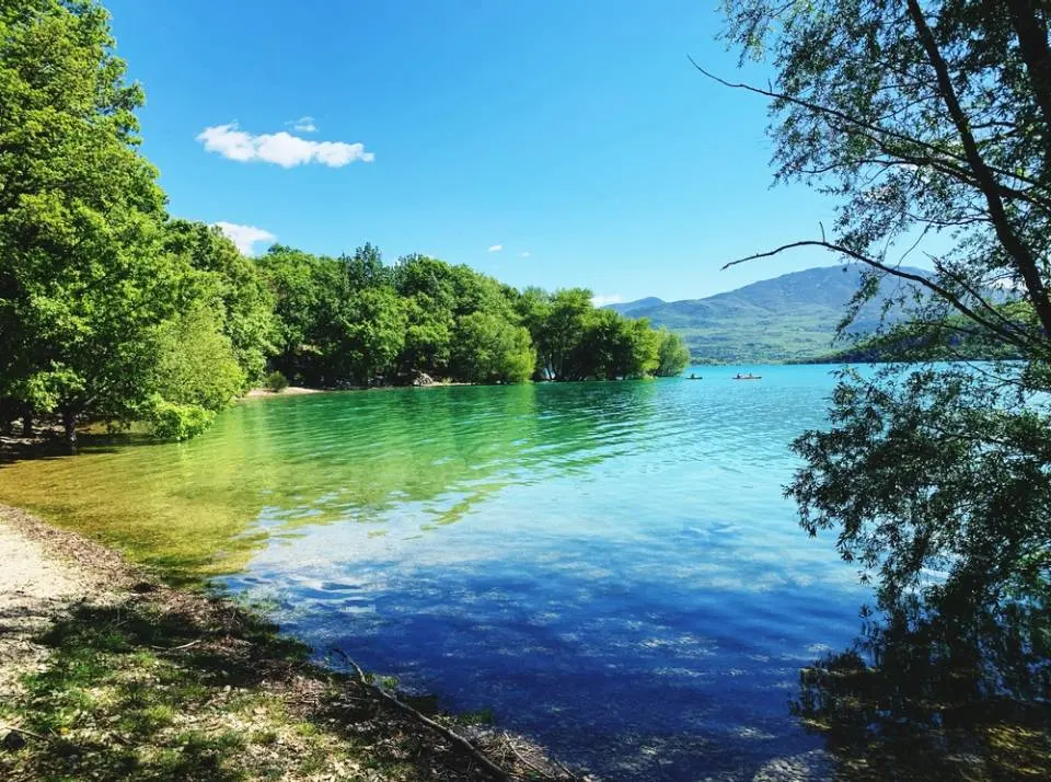
Lac de Montpezat

Coordinates43.75082, 6.09057
Published byarnavo.69
21 Apr 2025 · 08:26 PM
Community score
0

Log in to vote

Categories
🌊 Plan d'eau🌳 Arbres
Aviation weather· 04
Comments· 05

No comments yet. Be the first!

Log in to comment

Nearby spots· 06
  • Ste CroixBauduen4.8 km
  • Village de BaudinardBaudinard-sur-Verdon4.9 km
  • chapelle Notre Dame de BaudinardBaudinard-sur-Verdon5.1 km
  • Basses gorges du verdonQuinson7.9 km
  • plage du village des SallesLes Salles-sur-Verdon9.6 km
  • Bord du Lac d'EsparonEsparron-de-Verdon10.2 km
  • lac d espadonEsparron-de-Verdon11 km
  • Plateau de ValensoleValensole13.1 km
Live wind· 07
Windy
Lac de Montpezat
Pilot briefing
Difficulty
2/3
Medium
Accessibility
2/3
Moderately accessible
Description

Le lac de Montpezat est un petit plan d’eau niché entre collines et gorges, parfait pour voler en drone quand il fait beau. L’eau est calme, entourée de végétation méditerranéenne, et les paysages sont superbes, surtout sous le soleil. On peut y capturer de belles images en survolant les rives, les reliefs boisés ou les reflets du ciel dans l’eau. Le vol est autorisé, mais il faut savoir que le lac se trouve proche d’une zone interdite, donc il est important de rester dans les zones ouvertes au vol. La hauteur maximale est limitée à 50 mètres sur ce site. Le lieu est accessible facilement, avec des spots tranquilles pour décoller en toute sécurité. Idéal pour du vol cinématique ou une balade tranquille en FPV
Can I fly here?· 03

Conditional: prior notification

Prior notification is required for drones of 900 g or more.

Max height : 120 m

  • [LF][VOLTAC LUC]Conditional

    Military training sector: with a drone of 900 g or more, notify your flight on AlphaTango, by 6 am on the day of the flight at the latest (noon for a flight after 2 pm).

  • NOTAM W2493/26No known restriction

    NOTAM in force at this spot. Read it before flying.

  • Plateau de ValensoleNo known restriction

    Protected area with no known overflight ban. Respect wildlife and plants.

  • ValensoleNo known restriction

    Protected area with no known overflight ban. Respect wildlife and plants.

A local order (prefecture, town hall) may also restrict flying. Stay alert on site.

Computed on November 16 at 06:49 PM

See on the map
Mon, Nov 16
5:49 PM
Conditions
Sunrise
Sunset
Precipitations
Temperature
KP index
Cloud cover
Wind speed
Wind gust
Visibility
Humidity
Satellites
DroneSpot Pro

Plan your flights in advance and find your windows with access to detailed 10-day forecasts showing conditions, satellites, wind, kp index, and more.