1. Home
  2. France
  3. Centre-Val de Loire
  4. Villandry
Villandry

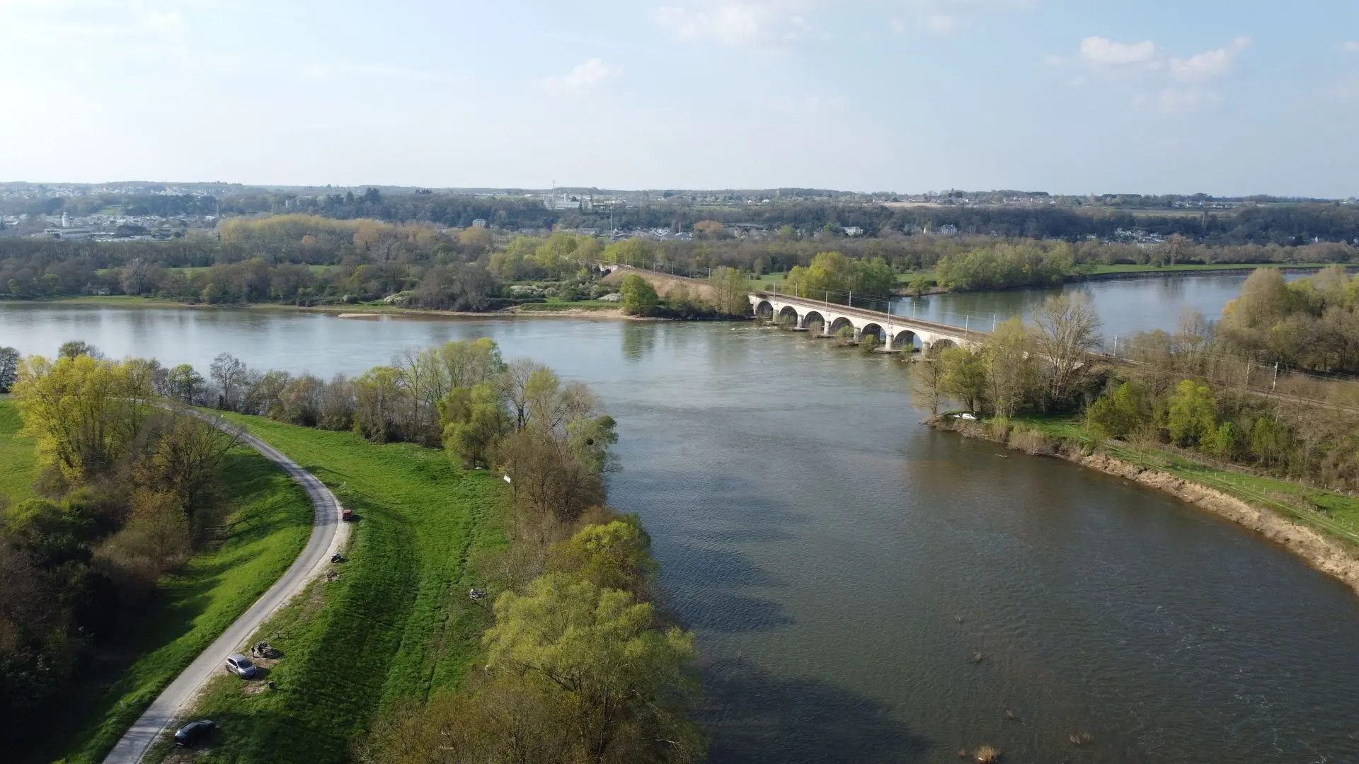
Confluence Loire Cher

Coordinates47.34356, 0.47939
Published byNico2685
23 Mar 2026 · 06:45 AM
Community score
0

Log in to vote

Categories
🌊 Plan d'eau
Aviation weather· 04
Comments· 05

No comments yet. Be the first!

Log in to comment

Nearby spots· 06
  • Île de BréhémontLangeais9.3 km
  • Le grand chêneBallan-Miré10.7 km
  • Parc de la PasquerieBallan-Miré10.7 km
  • Plage rupuanneRigny-Ussé15 km
  • Château abandonné de GrandfondÉpieds43.1 km
  • Château de la Mothe-ChandeniersLes Trois-Moutiers43.8 km
  • Château de ChenonceauChenonceaux44.6 km
  • Rmcf FPV racingLa Flèche52.8 km
Live wind· 07
Windy
Confluence Loire Cher
Pilot briefing
Difficulty
2/3
Medium
Accessibility
2/3
Moderately accessible
Description

Altitude limitée 50m mais spot sympa où le cher se jette dans la Loire, avec un pont ferroviaire en bonus pour des plans sympas si un train passe
Restrictions here· 03

No known restrictions at this point.

Always cross-check before flying — coverage depends on your country's published data.

Tue, Nov 10
6:17 AM
Conditions
Sunrise
Sunset
Precipitations
Temperature
KP index
Cloud cover
Wind speed
Wind gust
Visibility
Humidity
Satellites
DroneSpot Pro

Plan your flights in advance and find your windows with access to detailed 10-day forecasts showing conditions, satellites, wind, kp index, and more.