1. Home
  2. France
  3. Haute-Corse
  4. Rogliano
Rogliano

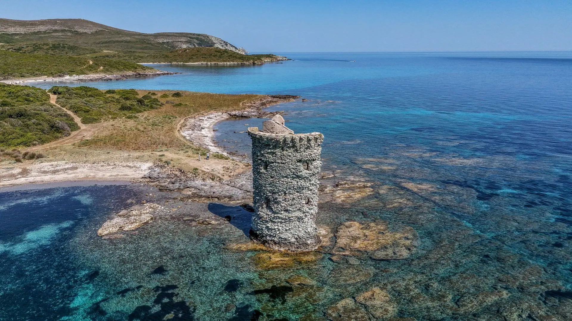
Tour de Santa Maria (Cap corse)

Coordinates42.99071, 9.45175
Published byAMLE
29 May 2026 · 09:03 AM
Community score
0

Log in to vote

Categories
🌊 Plan d'eau
Aviation weather· 04
Comments· 05

No comments yet. Be the first!

Log in to comment

Nearby spots· 06
  • Plage de NonzaNonza23.3 km
  • Plage de nonzaNonza24.1 km
  • Plage Hôtel Alivi Bastia Ville-di-Pietrabugno30.5 km
  • Pointe du petit LotoSaint-Florent34.3 km
  • Route d.Oletta belvédèreBarbaggio35.2 km
  • Plage de SalecciaSanto-Pietro-di-Tenda35.3 km
  • Plage de Sallecia - Embouchure du LiscuSanto-Pietro-di-Tenda36 km
  • tour de FornaliSaint-Florent36.6 km
Live wind· 07
Windy
Tour de Santa Maria (Cap corse)
Pilot briefing
Difficulty
2/3
Medium
Accessibility
2/3
Moderately accessible
Description

Accès par le sentier des douaniers en une heure de marche au départ de la plage de Tamarone.
Can I fly here?· 03

To confirm: temporary area

A temporary area published by NOTAM or AIP SUP may cover this spot. Check its exact outline before flying.

Max height : 120 m

  • SUP AIP 233/2024To be confirmed

    Temporary danger area in force: no flying without the approval of its operator.

  • Plateau du Cap CorseNo known restriction

    Protected area with no known overflight ban. Respect wildlife and plants.

  • Plateau du Cap CorseNo known restriction

    Protected area with no known overflight ban. Respect wildlife and plants.

A local order (prefecture, town hall) may also restrict flying. Stay alert on site.

Computed on November 21 at 06:08 PM

See on the map
 
--:--
Conditions
Sunrise
Sunset
Precipitations
Temperature
KP index
Cloud cover
Wind speed
Wind gust
Visibility
Humidity
Satellites
Drone Spot Pro

Plan your flights in advance and find your windows with access to detailed 10-day forecasts showing conditions, satellites, wind, kp index, and more.