1. Home
  2. France
  3. Hauts-de-France
  4. Audinghen
Audinghen

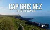
Randonnée sentier des Douaniers - Cap Gris Nez

Coordinates50.84663, 1.58845
Published bySebdrone62
31 Aug 2026 · 04:03 PM
Community score
0

Log in to vote

Categories
🌊 Plan d'eau
Aviation weather· 04
Flight footage· 05
Comments· 06

No comments yet. Be the first!

Log in to comment

Nearby spots· 07
  • Le Cran aux Oeufs - Audinghen - Cap Gris NezAudinghen< 1 km
  • Le Cran du Noirda - AudressellesAudresselles1.9 km
  • Village d'Audresselles, sa Plage et la MerAudresselles2.7 km
  • Epave du Lord Grey - Plage du Châtelet TardinghenAudinghen3.7 km
  • Nuances du Lord Grey - TardinghenTardinghen3.7 km
  • Plage du ChateletTardinghen4.4 km
  • Le Fort d'Ambleteuse / Fort VaubanAmbleteuse4.6 km
  • Moissons 2026 - Audembert & TardinghenTardinghen5 km
Live wind· 08
Windy
Randonnée sentier des Douaniers - Cap Gris Nez
Pilot briefing
Difficulty
3/3
Hard Level
Accessibility
1/3
Easy to access
Description

-Marche Matinale au Cap Gris Nez sur le sentier des Douaniers entre le Phare du Cap gris Nez (Cross Gris nez) et le Cran Poulet
Restrictions here· 03

No known restrictions at this point.

Always cross-check before flying — coverage depends on your country's published data.

Wed, Nov 11
2:11 AM
Conditions
Sunrise
Sunset
Precipitations
Temperature
KP index
Cloud cover
Wind speed
Wind gust
Visibility
Humidity
Satellites
DroneSpot Pro

Plan your flights in advance and find your windows with access to detailed 10-day forecasts showing conditions, satellites, wind, kp index, and more.