1. Home
  2. France
  3. Centre-Val de Loire
  4. Saint-Denis-en-Val
Saint-Denis-en-Val

Parc de Loire

Coordinates47.89944, 1.97250
Published byjujudr400
03 Oct 2026 · 08:58 PM
Community score
0

Log in to vote

Categories
🌊 Plan d'eau🌳 Arbres
Aviation weather· 04
Comments· 05

No comments yet. Be the first!

Log in to comment

Nearby spots· 06
  • Pointe de CourpainSaint-Pryvé-Saint-Mesmin11 km
  • Bord de loireOuvrouer-les-Champs16.2 km
  • Château d'eau de TrinayTrinay20.3 km
  • Zone de vol forêtHuisseau-sur-Mauves23 km
  • Zone de décollageLe Bardon24.2 km
  • la Loire a BeaugencyBaule25.4 km
  • Moulin bel airGuilly25.8 km
  • Eoliennes d'Aschères-le-Marché (Loiret, France)Oison26 km
Live wind· 07
Windy
Parc de Loire
Pilot briefing
Difficulty
2/3
Medium
Accessibility
2/3
Moderately accessible
Description

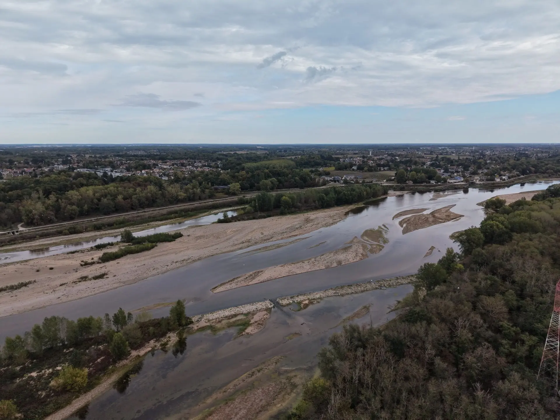
Décollage depuis le bord de Loire, vue imprenable sur le fleuve ainsi que les étangs juste derrière.
Can I fly here?· 03

Flight allowed

No regulated zone at this spot. Fly up to 120 m, in daylight, with your drone in sight, away from people.

Max height : 120 m

  • Vallée de la Loire de Tavers à Belleville-sur-LoireNo known restriction

    Protected area with no known overflight ban. Respect wildlife and plants.

  • Vallée de la Loire du LoiretNo known restriction

    Protected area with no known overflight ban. Respect wildlife and plants.

A local order (prefecture, town hall) may also restrict flying. Stay alert on site.

Computed on November 15 at 12:54 AM

See on the map
Sat, Nov 14
11:54 PM
Conditions
Sunrise
Sunset
Precipitations
Temperature
KP index
Cloud cover
Wind speed
Wind gust
Visibility
Humidity
Satellites
DroneSpot Pro

Plan your flights in advance and find your windows with access to detailed 10-day forecasts showing conditions, satellites, wind, kp index, and more.