Route de la Sainte Baume
  1. Home
  2. France
  3. Provence-Alpes-Côte d'Azur
  4. Gémenos
Gémenos

Route de la Sainte Baume

Coordinates43.30654, 5.66543
Published byVisiteur web
01 Jan 2019 · 12:00 AM
Community score
0

Log in to vote

Aviation weather· 04
Comments· 05

No comments yet. Be the first!

Log in to comment

Live wind· 06
Windy
Pilot briefing
Difficulty
2/3
Medium
Accessibility
1/3
Easy to access
Description

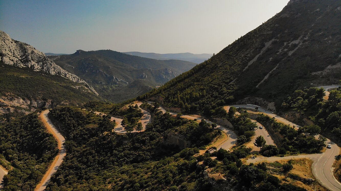
Superbe route de montagne qui monte depuis Gémenos jusqu’au Plan D’Aups ! Possibilité de s’arrêter à plusieurs endroits pour faire quelques plans jusqu’au col de lespigoulier, mais attention à la zone rouge qu’on est très près et attention à ne pas à survoler de voiture pour prendre la route en photo !

Restrictions here· 03
3 active rules
  • [LF][VOLTAC LUC]Aerodrome / other · No-fly
  • WUActive now
  • ROActive now
Sun, Jul 5
2:49 AM
Conditions
Sunrise
Sunset
Precipitations
Temperature
KP index
Cloud cover
Wind speed
Wind gust
Visibility
Humidity
Satellites
DroneSpot Pro

Plan your flights in advance and find your windows with access to detailed 10-day forecasts showing conditions, satellites, wind, kp index, and more.