1. Home
  2. France
  3. Bretagne
  4. Landunvez
Landunvez

Côte Penfoul

Coordinates48.52610, -4.76144
Published bycharlesglmt
11 Apr 2018 · 12:00 AM
Community score
0

Log in to vote

Categories
🌊 Plan d'eau
Aviation weather· 04
Comments· 05

No comments yet. Be the first!

Log in to comment

Nearby spots· 06
  • Penfoul bateauxLandunvez< 1 km
  • Côte PorspoderPorspoder1.3 km
  • Cote PorspoderPorspoder1.5 km
  • Portsalle Landunvez4.7 km
  • Île SegalPlouarzel9.7 km
  • dune de sainte margueriteLandéda14.2 km
  • Fort illienPloumoguer15.7 km
  • Plage des Blancs SablonsLe Conquet17.5 km
Live wind· 07
Windy
Côte Penfoul
Pilot briefing
Difficulty
2/3
Medium
Accessibility
2/3
Moderately accessible
Description

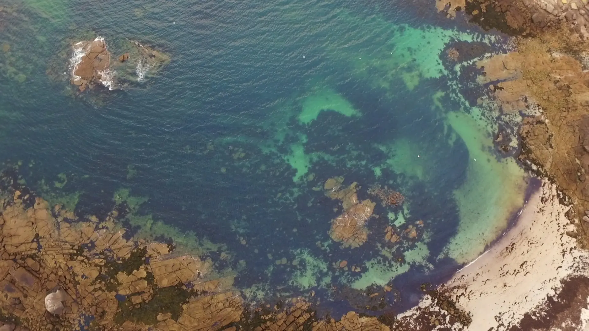
Eau bleue turquoise en temps nuageux, plans conseillés de haut, caméra vers le bas pour montrer le relief et la couleur de l'eau. Attention au vent.
Restrictions here· 03
2 active rules
  • [LF][Aer 8425-2] LANDUNVEZ 2 (29)Aerodrome / other · No-fly
  • WEUpcoming
Wed, Nov 11
1:54 AM
Conditions
Sunrise
Sunset
Precipitations
Temperature
KP index
Cloud cover
Wind speed
Wind gust
Visibility
Humidity
Satellites
DroneSpot Pro

Plan your flights in advance and find your windows with access to detailed 10-day forecasts showing conditions, satellites, wind, kp index, and more.