1. Home
  2. France
  3. Occitanie
  4. Hérault
  5. Maraussan
Maraussan

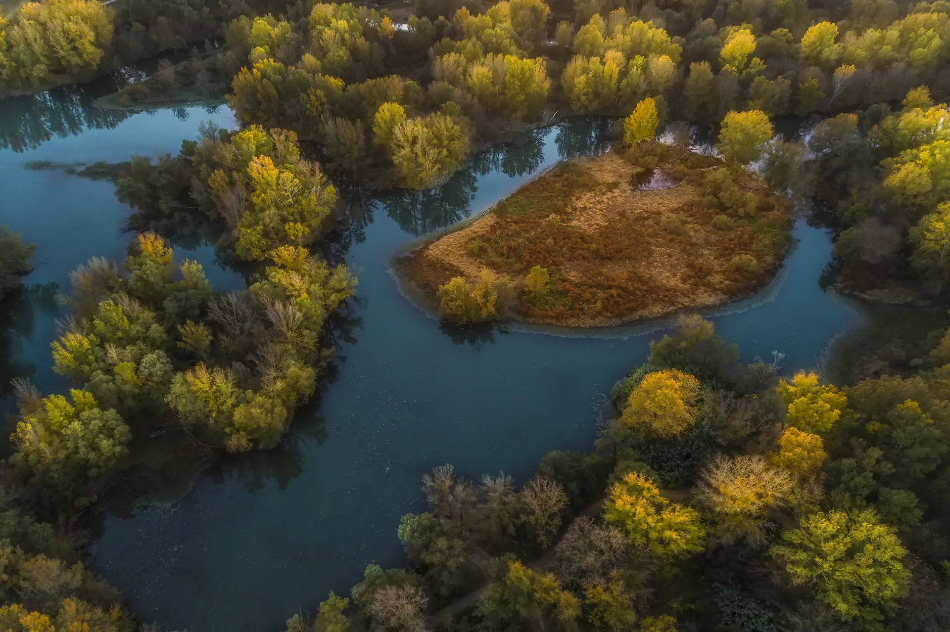
Plan d'eau de La Malhaute

Coordinates43.39659, 3.15391
Published bybenoit
28 May 2018 · 12:00 AM
Community score
0

Log in to vote

Aviation weather· 04
Comments· 05

No comments yet. Be the first!

Log in to comment

Nearby spots· 06
  • Pont suspenduThézan-lès-Béziers2.5 km
  • Étang base de loisir de savignacThézan-lès-Béziers2.7 km
  • L'étang asséché de MontadyMontady8.2 km
  • Notre-Dame de BadonesBéziers9.8 km
  • Stade Raoul BarrièreBéziers10.5 km
  • Les moulins de Nissan lez EnsérunesNissan-lez-Enserune13 km
  • Château Abbaye de CassanRoujan16.5 km
  • Pic de la coquilletteCabrerolles17.4 km
Live wind· 07
Windy
Plan d'eau de La Malhaute
Pilot briefing
Difficulty
2/3
Medium
Accessibility
2/3
Moderately accessible
Description

Beaucoup d'arbres et d'oiseaux, quelques pêcheurs mais il y a de quoi faire de beaux films et belle photos en toute sécurité.
Can I fly here?· 03

Flight allowed

No regulated zone at this spot. Fly up to 120 m, in daylight, with your drone in sight, away from people.

Max height : 120 m

A local order (prefecture, town hall) may also restrict flying. Stay alert on site.

Computed on November 20 at 05:14 PM

See on the map
 
--:--
Conditions
Sunrise
Sunset
Precipitations
Temperature
KP index
Cloud cover
Wind speed
Wind gust
Visibility
Humidity
Satellites
Drone Spot Pro

Plan your flights in advance and find your windows with access to detailed 10-day forecasts showing conditions, satellites, wind, kp index, and more.