1. Home
  2. France
  3. Hauts-de-France
  4. Beauvais
Beauvais

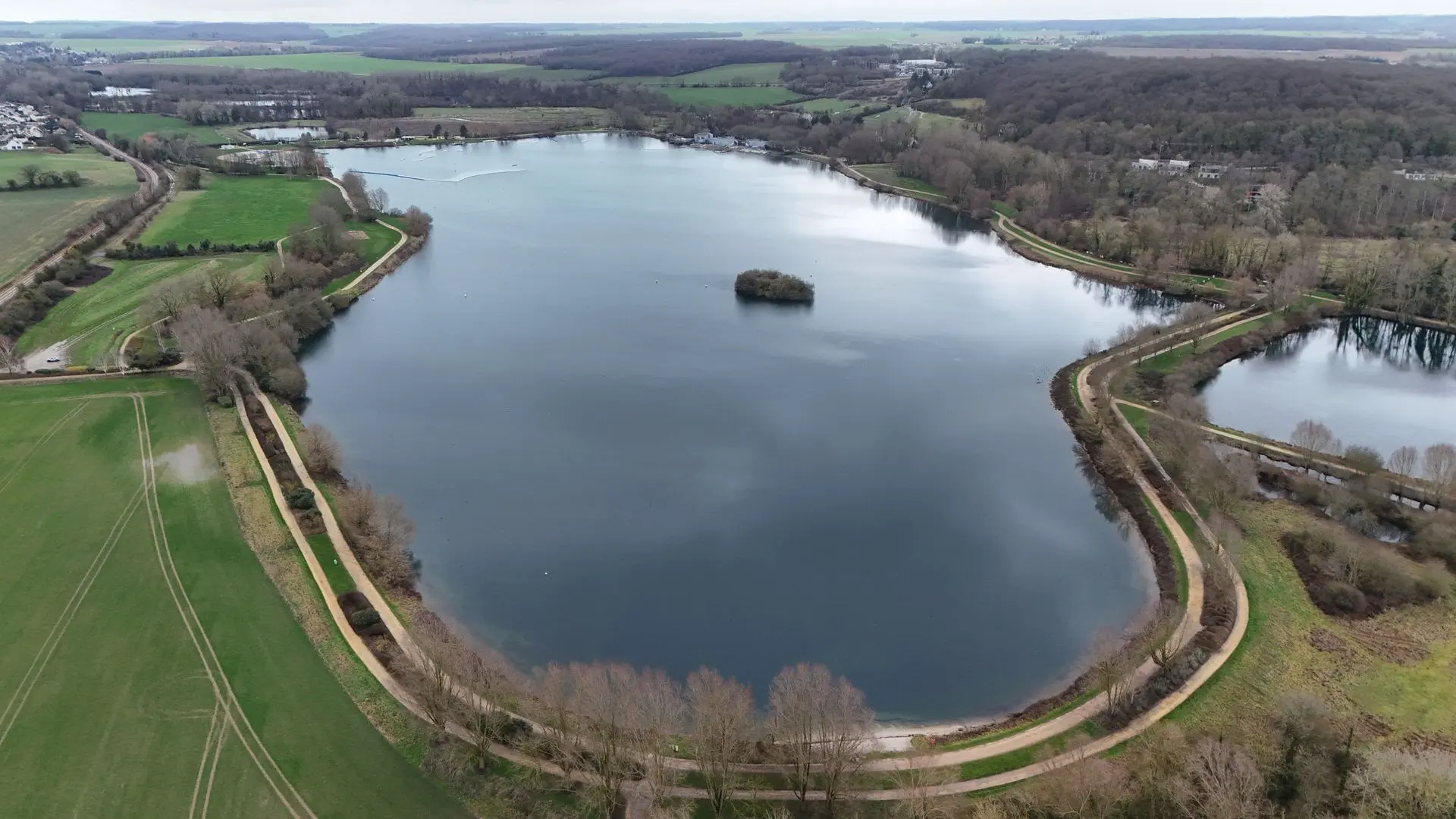
Le plan d'eau du Canada

Coordinates49.44723, 2.05494
Published byCyrilleDoZ
05 Feb 2026 · 04:00 PM
Community score
0

Log in to vote

Categories
🌊 Plan d'eau
Aviation weather· 04
Comments· 05

No comments yet. Be the first!

Log in to comment

Nearby spots· 06
  • EGLISE DE SAINT SULPICESaint-Sulpice11.4 km
  • La coulée verteCrèvecœur-le-Grand18.6 km
  • Chateau d'eau de MéruMéru23.7 km
  • théâtre gallo-romainVendeuil-Caply25.4 km
  • Château de fitz jamesFitz-James26.5 km
  • Église Saint-Gilles-Saint-Leu de BoubiersBoubiers28.1 km
  • Les étangs de Breuil le secBreuil-le-Sec30.2 km
  • Eglise St Quentin de NucourtNucourt35 km
Live wind· 07
Windy
Le plan d'eau du Canada
Pilot briefing
Difficulty
2/3
Medium
Accessibility
2/3
Moderately accessible
Description

Le plan d'eau du Canada est un lac artificiel situé au nord-ouest de Beauvais et le long du Thérain, un affluent de l'Oise. Situé sur la rive droite du Thérain, il possède un sentier de 3 kilomètres tout au long de ses berges et est ouvert à la baignade de juillet à août.
Restrictions here· 03
5 active rules
  • Piste 12/30 aérodrome BEAUVAIS TILLE LFOBAerodrome / other · ≤ ~72 m · 3 layers
  • Hélistation BEAUVAIS CENTRE HOSPITALIERAerodrome / other · No-fly · 3 layers
  • [LF][CTR BEAUVAIS]Aerodrome · ≤ 50 m
  • Piste 04/22 aérodrome BEAUVAIS TILLE LFOBAerodrome / other · ≤ ~92 m · 2 layers
  • Beauvais Tille (Tillé) — Volume 100 mAerodrome / other · ≤ 100 m
Tue, Nov 10
2:00 PM
Conditions
Sunrise
Sunset
Precipitations
Temperature
KP index
Cloud cover
Wind speed
Wind gust
Visibility
Humidity
Satellites
DroneSpot Pro

Plan your flights in advance and find your windows with access to detailed 10-day forecasts showing conditions, satellites, wind, kp index, and more.