1. Home
  2. France
  3. Bretagne
  4. Plougastel-Daoulas
Plougastel-Daoulas

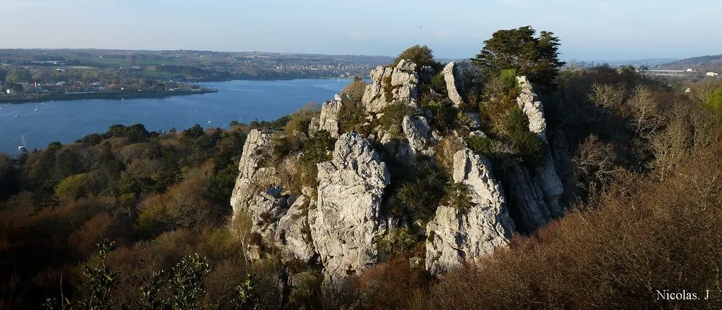
Rocher de l'impératrice

Coordinates48.38903, -4.37568
Published bycamille_f
23 Mar 2018 · 12:00 AM
Community score
0

Log in to vote

Categories
🌊 Plan d'eau➰ Freestyle📡 Long range
Aviation weather· 04
Comments· 05

No comments yet. Be the first!

Log in to comment

Nearby spots· 06
  • Pont de PlougastelPlougastel-Daoulas< 1 km
  • Anse du Moulin BlancGuipavas3.9 km
  • Menez-HomDinéault21.5 km
  • Lac du drennecCommana27.1 km
  • Anse de KervijenPloéven27.5 km
  • Mousse ConquetLe Conquet28 km
  • La baie du CurnicGuissény28.1 km
  • Le KoréjouPlouguerneau28.5 km
Live wind· 07
Windy
Rocher de l'impératrice
Pilot briefing
Difficulty
1/3
Beginner
Accessibility
1/3
Easy to access
Description

Falaise difficile d'accès et dangereuse.Vue époustouflante sur la rade de Brest et le Relecq Kerhuon. Accès à pieds d'environ 30 minutes.
Restrictions here· 03
4 active rules
  • [LF][CTR BRETAGNE]Aerodrome · ≤ 50 m
  • Piste 07R/25L aérodrome BREST BRETAGNE LFRBAerodrome / other · ≤ ~65 m · 2 layers
  • OBActive now
  • WEUpcoming
Wed, Nov 11
12:31 AM
Conditions
Sunrise
Sunset
Precipitations
Temperature
KP index
Cloud cover
Wind speed
Wind gust
Visibility
Humidity
Satellites
DroneSpot Pro

Plan your flights in advance and find your windows with access to detailed 10-day forecasts showing conditions, satellites, wind, kp index, and more.