1. Home
  2. France
  3. Île-de-France
  4. Les Bréviaires
Les Bréviaires

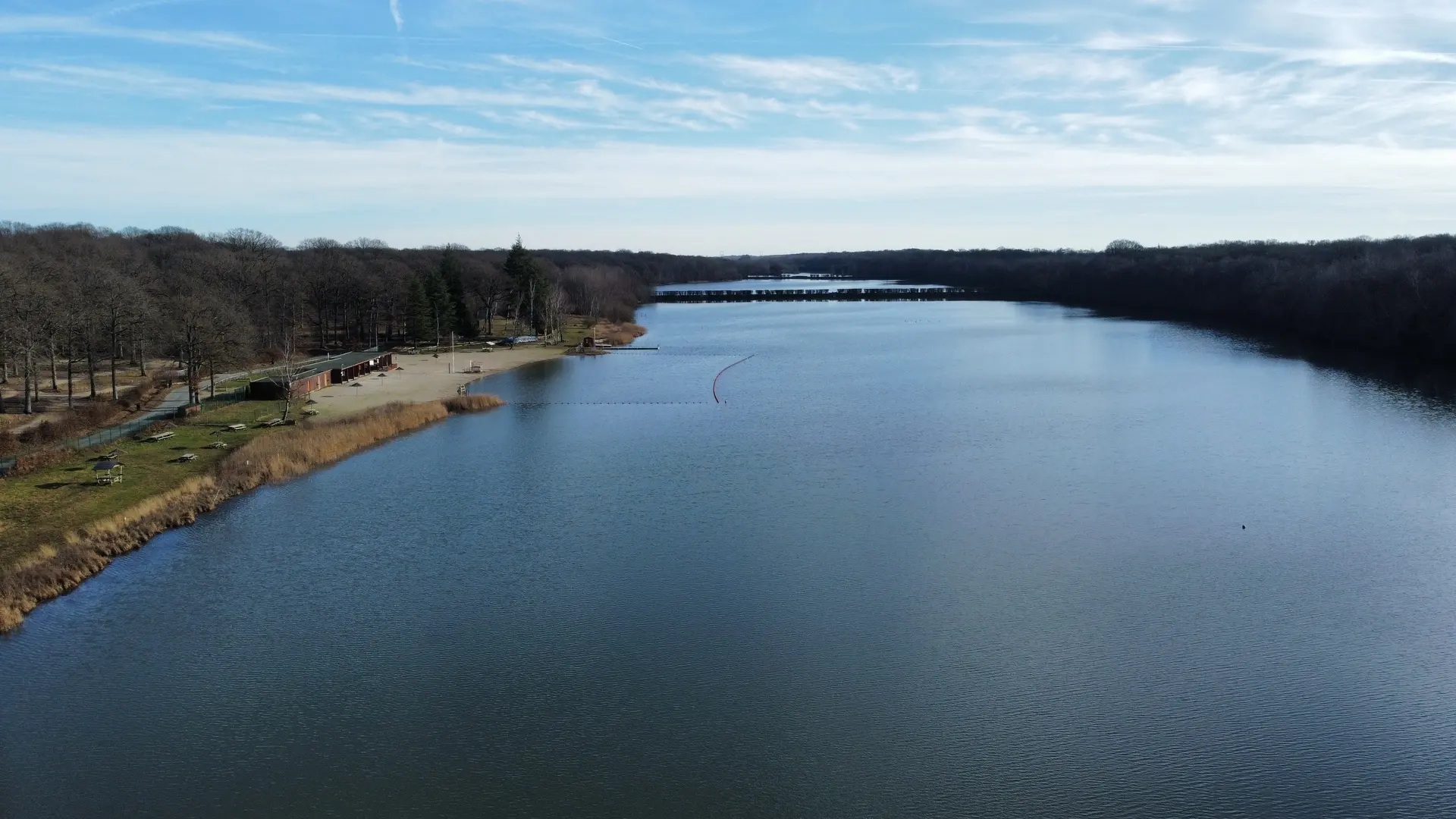
Etang de holland

Coordinates48.72945, 1.79918
Published byquentin.r
28 May 2022 · 09:11 AM
Community score
0

Log in to vote

Aviation weather· 04
Comments· 05

No comments yet. Be the first!

Log in to comment

Nearby spots· 06
  • Entraînement en champ libreMaurepas9.9 km
  • Rambouillet - étang de la TourRambouillet10.4 km
  • Le grand etangMaurepas10.5 km
  • ferme du mousseauÉlancourt13 km
  • Colline de la revancheÉlancourt14 km
  • SQY Drone (Club de drone)Trappes16 km
  • Route du viviers aux MoinesSaint-Nom-la-Bretèche21 km
  • Chemin de la Chapelle - RennemoulinRennemoulin21.1 km
Live wind· 07
Windy
Etang de holland
Pilot briefing
Difficulty
2/3
Medium
Accessibility
2/3
Moderately accessible
Description

Etang avec une petite base de loisirs et des « ponts » qui le traverse. Pas de difficulté particulière hormis les arbres et les piétons. Largement réalisé par un debutant.
Can I fly here?· 03

Prohibited

At least one restriction prohibits flying at this spot.

Max height : —

  • [LF][PRN 046] ETANGS ET RIGOLES D'YVELINEProhibited

    No-fly zone from the ground up.

  • [LF][R 324] VEILLE REGION PARISIENNEProhibited

    No-fly zone from the ground up.

  • [LF][VOLTAC GIH]No known restriction

    Military training sector, inactive at that time: nothing to do.

  • Massif de Rambouillet et zones humides prochesNo known restriction

    Protected area with no known overflight ban. Respect wildlife and plants.

A local order (prefecture, town hall) may also restrict flying. Stay alert on site.

Computed on November 15 at 01:12 AM

See on the map
Sun, Nov 15
12:12 AM
Conditions
Sunrise
Sunset
Precipitations
Temperature
KP index
Cloud cover
Wind speed
Wind gust
Visibility
Humidity
Satellites
DroneSpot Pro

Plan your flights in advance and find your windows with access to detailed 10-day forecasts showing conditions, satellites, wind, kp index, and more.